
I recently had to to go to Kent at short notice, and since I was heading into relatively unknown territory on a long journey, I zero’d my satnav trip details, a rare event.
When I got home, I flipped to the trip detail screen and was tickled to see this trip record shown below…

The distance looks right, but behold, my Max Speed was apparently 242 mph – was I driving a Bugatti Veyron (top speed 258 mph)? – I think not!
This makes you think about how useful is GPS data as the foundation of a national road pricing system – the answer is probably in chocolate teapot territory!
Many people think that a satellite based road pricing system would work roughly like this…
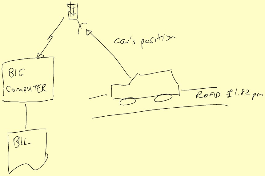
…with the satellites somehow detecting the position of your car and then transmitting the data to the Big Computer that adds up the price of the the roads you have been sitting on, and then issuing a bill.
But of course the satellites don’t detect the position of the car at all, it is the Black Box in the car that does all the work, and so a GPS-satellite based road pricing system would really work something like this….
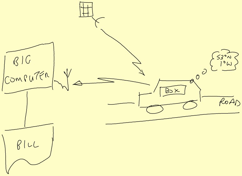
…with the car working out where it thinks it is, and then (somehow, by mobile phone, maybe) sending the data to the Big Computer that…well, you get the picture, don’t you…
If such a system were built, then once people twig the way things work, the little Black Boxes will be wearing tin-foil hats – to block the incoming satellite signal, and then to stop the mobile phone signal going out; result: No road travel data = no payment.
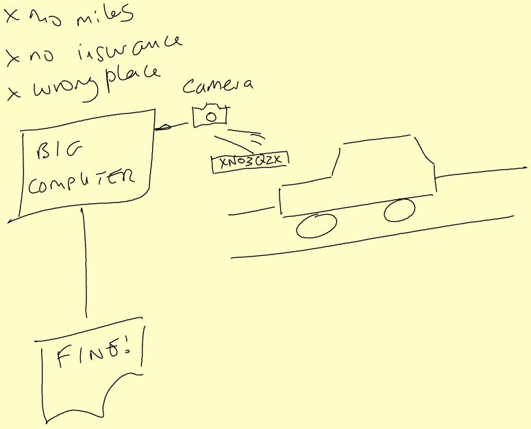
So the Power-That-Be would have design some sort of method of enforcement. What better way than using the Automatic Number Plate Recognition (ANPR) cameras that are sprouting all over the place.
All you need to do is cross-relate the journey data received from the in-car black boxes with the location of sightings according to the cameras. The system would look something like this…
Thinking a bit harder than maybe my satnav did, then you can imagine many points of error:
- confused satnav systems
- lost distances travelled in tunnels, city canyons, and inside little tin foil hats
- black box failures, including maybe “failures” induced by sharp, stabbling screwdrivers
- failed/partial uploads of trip records
- misrecognised number plates
- cars and drivers missing from the database
- and more…
Aaaaaaaaaagh, a merry feast of error compounding upon error, a veritable panoply of tainted data, a concatenation of absurdity!
Multiplying up the error probabilities in this ordure-filled pipeline, and you will get a success probability in the mid-seventies percent. Not good…
I have previously mentioned the risk profile of Government IT projects so I won’t bang that particular drum again here, but you can always look here to remind yourself…
My trip would have earned me about 18-points on my licence, a big fine, a 5-year ban, and probably 6 months in chokey for apparently travelling at 182 mph faster than the National Speed limit.
So if/when we end up with a GPS-powered road pricing system, expect the worst!
Footnote: the charming and naively executed diagrams in this post where brought to you courtesy of a DigiScribble pen. It calls itself ” The Mobile Digital Note-Taker”, but using it underlined for me the fatal flaw of all write-only devices…you can’t see what it thinks you wrote until you upload – too late, way too late